By Andrew Liszewski
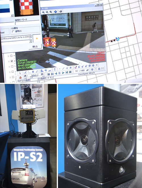
At the 3D & Virtual Reality Exhibition, which was recently held in Tokyo, a Japanese company called Topcon revealed a new scanning system that could one day bring road condition data to GPS devices. The system, known as IP-S2 Lite, uses a 360° camera combined with a laser scanner, an inclinometer and GPS positional data to generate a 3D representation of where it’s being driven through. The data allows accurate measurements to be made of everything captured in the video, including distance height and surface.
Most recently the new system was used to evaluate the damage and condition of roads in Japan in areas that were damaged by the recent earthquake. But it doesn’t seem like that much of a stretch to assume that it could also be used to generate accurate map data for GPS devices that better reflected the 3D nature of roadways like hills, dips and maybe even particularly egregious potholes.
[ DigInfo TV – Road Condition Evaluation System Measures Distance, Height and Area ] VIA [ Akihabara News ]


